In reviewing some online commentary about cell tower location data on various forums and websites purporting to offer free cell tower location data, I thought it might be helpful to explain what is available and what is not available to individuals looking for cell tower and cell site locations.
TYPES OF CELL TOWER AND CELL SITE DATA AVAILABLE
First, if you are looking for information about the type of cell sites, please see our page on the cell site types.
In the industry, we divide cell sites into three categories:
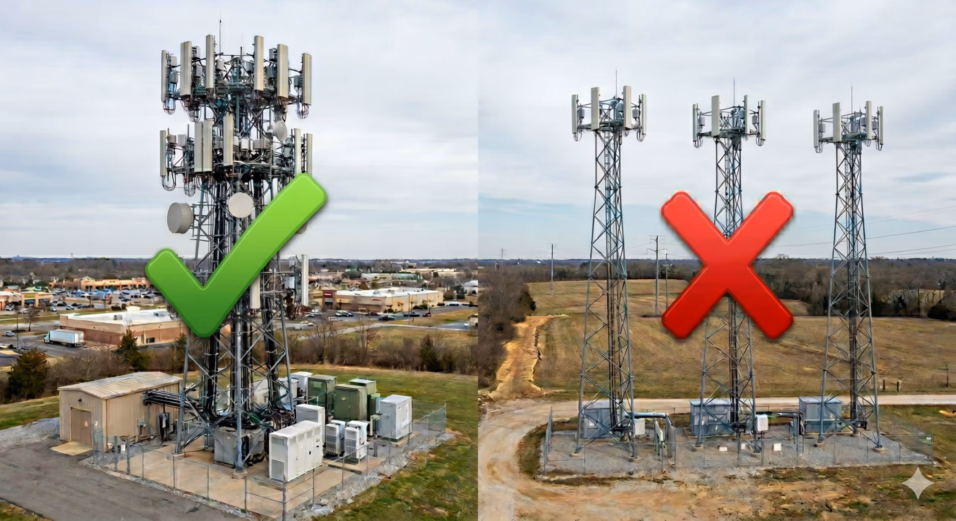
1. Rawland: A proposed site for a new tower which will accommodate multiple “cell sites” or “collocations”.
2. Collocations: The installation of a single carrier’s equipment and antennae on an existing tower.
3. Tenant Improvements: The improvement of an existing structure other than a tower. This can be a water tower, a building rooftop installation, or any other non-tower structure.
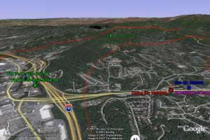
It is difficult to estimate the number of cell sites in existence. The industry (WIA) estimates there are approximately 155,000 cell towers and 254,000 cell sites in their annual report. We suspect the count is slightly higher on each. Unfortunately, the WIA does not provide granular datasets of all towers or macrocells (cell sites) We do have information on our cell tower companies page on the number of towers owned by the top 20 tower owners.
COMPLETENESS OF TOWER DATA.
To start with, there are no comprehensive tower databases that I am aware of, including Steel in the Air’s. We are contacted on a weekly basis by individuals looking to procure “cell tower” data. However, most of these people are actually looking for “cell site” data. They don’t need to know where towers are but instead want to know where each carrier has their sites. There are multiple reasons why they want to know:
1. Location Based Services (LBS): The wireless carriers are required by the FCC to be able to Enhanced 911 (e911) services for wireless devices which enables emergency providers to locate cellular handsets with a moderate degree of accuracy. Many entrepreneurs desire to use “cell site” locations and coordinates to establish locations for their wireless service. From the location of an individual cellular provider’s cell towers and cell sites, these entrepreneurs intend to triangulate their service’s user’s locations. Unfortunately, we are not aware of any commercially available service whereby this data can be purchased or is otherwise available except through from each individual carrier.
2. Comparison of Coverage: End users often want to know how strong the signal from a respective tower is in a given area. The carrier’s online coverage maps in some cases show strength of service to varying degrees but they do not show the location of cell sites.
3. Competitive Cell Tower Location Data: There are a handful of companies purporting to provide comprehensive datasets of tower data. Most of the best datasets for cell towers are privately owned and are not available for licensing or purchase (including Steel in the Air’s). We have been gathering tower data from hundreds of tower companies and tens of thousands of landowners over the last 29 years. We also maintain databases of individual cell site locations and have amassed 30,000 plus locations in our dataset.
4. Backhaul Alternatives: We are regularly contacted by entities that either own optical fiber rings or ones that are considering purchasing dark fiber to compare the location of fiber to the presence of cell towers and cell sites. These entities wish to determine where they can augment their income to provide backhaul services to wireless sites.
PUBLICLY AVAILABLE DATA
Many of the available online sources of tower data simply regurgitate the records available from the FCC. Please note that there is no requirement by the FCC or any other government agency to register individual “cell sites”. Cellular service is licensed by the region, meaning that the FCC grants the wireless carriers a general license for a county or other geographic region. As long as they conform to the frequency and power limitations of these licenses, they can build anywhere (with local zoning approval).
There are numerous types of data available from the FCC for antenna sites. However, these online sources do not distinguish between what the datasets provide. This appears to create a good deal of confusion between users. Below are some of the datasets provided by the FCC.
1. Antenna Structure Registrations. (ASR) Many of the free online sites for tower data use this as the base data. (Antenna Search.com, Cell Reception.com) Antenna Structure Registration is required by the FCC for those tower sites that pose a threat to air safety. In short, this means towers that are over 200’ tall or those towers that are within 5 miles of an airport. Accordingly, if a tower is under 200’ and is not within 5 miles of an airport, it does not have to be registered with the FCC. (For a indication of how many towers exceed 200′ tall- see our previous post on cell tower heights.) It is important to note that ASRs are only necessary for towers- not cell sites. Oftentimes, the owner of the antenna structure or “cell tower” is not the wireless carrier, it is a tower company who built the tower or a tower aggregator like American Tower or Crown Castle who purchased the tower sites from the wireless carriers. To complicate matters, many of the FCC ASRs are not actually used for cellular communications. They can be two way radio towers or broadcast towers or other wireless internet service towers. There are approximately 170,000 antenna structure registrations.
2. Specific Frequency Licensed Locations. The FCC does require some wireless services to register individual locations. There are numerous databases available from the FCC on different wireless service types. For instance, most microwave installations require specific site registrations. Paging and mobile radio installations do as well. Some of the online services purporting to provide data about cell towers actually use the frequency databases. Unfortunately, these locations rarely equate to cellular towers or “cell sites”. So someone viewing these databases will end up paying for what they presume to be cell tower data and in reality they are paying for paging locations or two-way radio locations. (or even Ham Radio).
In essence, if you use the free services that regurgitate the FCC data, recognize that you are getting what you paid for. I personally would not waste my money on any service that offers to sell you the FCC data. (It is available for free from other online sites and can be downloaded from the FCC website for free, although the translation of the database is not simple.)
STEEL IN THE AIR DATA
We have assembled a comprehensive database of tower and cell site locations from numerous sources, including the public FCC data, FAA data, and tower companies that provide their data online. We also have represented over 4000 clients with cell site leases for a few thousand cell sites. For many of those clients, they helped fill in missing data in their area by driving around. In addition, we have independently gathered specific cell site from various sources including paying people to literally drive areas of interest and visually identify towers. Some of our data includes lease rate data, most of it doesn’t. We use our data to assist our clients with determining where cell sites are. In a number of cases, we don’t have complete cell site data for an area. However, we know how to “fill in the holes” and how to assess areas for existing cell sites. In short, we make it our business to collect cell tower and cell site data and create tower location maps. We use this data to better serve our landowner, building owner, and tower company clients with market leading data and analysis. We do not sell or license access to our database.

1 thought on “CELL TOWER AND CELL SITE LOCATION DATA: A PRIMER”
It would possibly be in the best interest of the main providers to publicly locate their transmission location.
WHY.??..with the use of boosters and directional antennas the service coverage could actually be enlarged without adding sites towers o. Serve more users with out higher cost and yet better service meaning more phone sales , data and service packages as we are purchasing our own directional antennas and boosters.